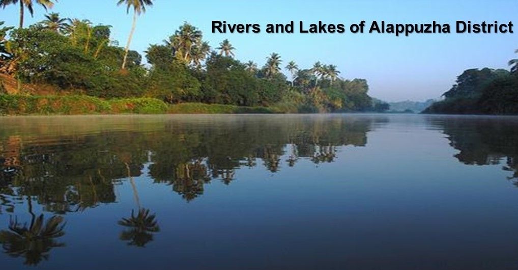
Alappuzha, a coastal gem in the Indian state of Kerala, is affectionately dubbed the "Venice of the East" and for good reason. The district is a dazzling mosaic of rivers, lakes, canals, and backwaters, each contributing to the region’s lush landscape, vibrant ecology, and unique culture. From the tranquil flow of rivers like Manimala and Pamba to the expansive Vembanad and Kayamkulam lakes, Alappuzha’s water bodies have sculpted its past and shape its present.
Rivers That Shape the Land
Manimala River
Originating from the Mothavara hills in Kottayam district, the Manimala River gracefully enters Alappuzha at Thalavadi village. Winding its way through Edathua and Champakulam, the river eventually merges with the Pamba River at Muttar. Villages along its path such as Manimala, Mallappally, and Kalloppara benefit from its fertile banks and scenic beauty. Spanning a length of 91.73 km and draining an area of 802.90 sq. km, Manimala supports agriculture and navigation, making it vital to local livelihoods.
Pamba River
The third longest river in Kerala, Pamba originates from the Peerumedu plateau in Idukki district and enters Alappuzha at Chengannur. It carves a spectacular route through Pandanad, Veeyapuram, and Thakazhy before discharging into the Vembanad Lake through various distributaries. Navigable for 73 km of its total 117 km length, Pamba sustains agriculture, water transport, and religious tourism especially to the Sabarimala temple. It also has a vast catchment area of 1987.17 sq. km and is nourished by tributaries such as Pambayar, Kakki Ar, and Kallar.
Achankovil River
Often referred to as the Kulallada River, Achankovil has its roots in the Pasukida Mettu and Rishimalai hills of Kollam district. After entering Alappuzha at Venmony, the river traverses Cheriyanad, Puliyoor, and Chengannur before converging with Pamba at Veeyapuram. With a catchment area of 1155.14 sq. km and flowing about 32.19 km within the district, Achankovil serves as a freshwater source and supports numerous fishing communities.
Lakes That Mirror the Sky
Vembanad Lake
Vembanad Lake is Kerala's largest and most ecologically significant lake. Stretching 84 km in length and covering an area of 204 sq. km, it forms the heart of the West Coast canal system. Its shoreline hugs multiple taluks including Cherthala and Kuttanad in Alappuzha and Vaikom in Kottayam. The lake receives waters from rivers like Pamba, Manimala, and Meenachil, and hosts islands such as Pathiramanal (known for its tropical mystery), Perumbalam, and Pallippuram.
One of its engineering marvels is the Thanneermukkom regulator a mud barrier designed to stop saline water intrusion during tidal periods. This helps maintain the lake’s freshwater profile and protects paddy cultivation in the region. Vembanad is also a critical site for migratory birds and supports flourishing inland fisheries.
Kayamkulam Lake
Another watery treasure is the shallow Kayamkulam Lake. Stretching 30.5 km from Panmana to Karthikappally, it has an outlet to the sea through the Kayamkulam Barrage. Covering about 59.57 sq. km and averaging 2.4 km in width, the lake links to Ashtamudi Lake via the Chavara–Panmana canal. Its calm waters are perfect for inland navigation and host a rich diversity of aquatic life, adding economic and ecological value.
The Canal Network: Arteries of Alappuzha
Alappuzha’s canal system enhances its charm and functionality. Chief among them are the Vadai Canal, Commercial Canal, and the Link Canal which connects the two. These canals, part of the West Coast network, are essential for passenger movement, goods transportation, and tourism. Smaller inland canals also exist, primarily serving as lifelines for local communities and offering picturesque boat rides to travelers.
Inland Water Transport and Fisheries
Both lakes and canals play a major role in inland water transport across Alappuzha. From traditional snake boats to mechanized ferries, the waterways carry people and cargo with ease. The abundance of water bodies has also led to a thriving inland fishery sector, providing sustainable income and nutritional security to the local population.
Sea Coast and the ‘Chakara’ Phenomenon
Alappuzha boasts a flat, unbroken coastline of 82 km
about 13.9% of Kerala’s total coast. Each June, an extraordinary natural event called “Chakara” occurs. Due to hydraulic pressure from rising backwaters during the southwest monsoon, nutrient-rich mud banks shift along a 25 km stretch from Alappuzha to Purakkad. This brings fish closer to shore in large numbers, making it a fisherman’s paradise and a biological wonder.
In essence, the rivers and Lakes of Alappuzha are more than geographical features they’re vibrant ecosystems, cultural markers, and economic engines. Whether you're drifting through its canals or watching the sunrise over Vembanad, the district invites you to discover its rhythm, shaped entirely by water.